Map of the 245 seed zones developed for the eastern United States.
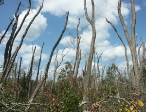
Plant seeds are the crucial starting point for innumerable conservation projects, from backyard butterfly gardens to large reforestation projects. For the USDA Forest Service and its many partners, tree, shrub, and herbaceous plants’ seeds and seedlings are needed in large numbers for forest restoration and land management work.
“In any such effort, it is important that land managers who purchase seeds are aware of their origin—ideally collected from areas with similar conditions to the project area,” says Carolyn Pike, regeneration specialist with the Forest Service Eastern Region’s State and Private Forestry program. Pike leads a project to create new seed-collection zones across the eastern U.S. for just this purpose.
The Eastern Seed Zone Forum (ESZF) is a network of scientists and partners from the Southern and Northern Regions of the National Forest System, the Eastern Region, and the Southern Research Station. ESZF works with stakeholders across the eastern U.S. to provide new tools for sourcing seeds for restoration projects, forest management, and other uses.
ESZF has produced a new seed-collection zone map, and the process used to create it was recently published in the Journal of Forestry
“What we really need is a system for describing ecological and climatic conditions where seeds are sourced, that can be applied everywhere in the eastern U.S.,” says Kevin Potter, a North Carolina State University scientist supported by the Southern Research Station and co-author of the publication. “Seeds, like their parent plants, are adapted to local conditions. With climate change, it is becoming even more important to know where seeds came from and therefore understand the conditions in which they will thrive in the future.”
The ESZF has made a draft version of the map available to the public. The researchers started with plant hardiness zones, which use minimum winter temperatures as the basis for cold tolerance maps. These zones were then overlaid onto ecoregions, which describe ecological conditions on the basis of geology, soils, native species, and other information. The final zones were aligned with counties, which is helpful for seed collectors to track the material they collect. Combining these information sources resulted in the delineation of 245 seed collection zones across 37 states.
Read the full Journal of Forestry article.
For more information, see this blog posting from the U.S. Forest Service Southern Research Station.
June 29, 2020